By Emily Friedel
The end of the Rubicon Valley is well worth exploring for its range of forest types, beautiful birdlife, and snippets of history. If you want to explore on foot, there are plenty of walking trails to lead you through this unique area.
The following guide describes a roughly 18-km circuit walk that takes you through various landscapes and relics. The walk is long, but all the tracks are in good condition with only gentle ups and downs (it’s a grade 3 hike). With the easy terrain, you should comfortably complete the entire walk in around 5 to 6 hours. If this is a bit daunting or if you’re time poor, there are some options for shorter walks at the end of this article.
There are sometimes road or bridge closures in the Rubicon Valley, including seasonal closures, so you may want to check with the Alexandra DELWP office regarding access to the area before going.
The beginning
Start at the intersection of Royston Road and Lebruns Road. To get here, drive up Rubicon Road, which becomes Rubicon River Road – the last 3 km are gravel but no 4WD necessary. Before reaching Rubicon Power Station, turn left over the post office bridge onto Royston Road.
Head up Royston Road for around 5 km to where it intersects with Lebruns Road. Park your car here, grab your gear, and start walking!
To Royston Power Station (approx. 1 hr)
Walk up (heading south) along Royston Road for around 2 km until you reach the Heritage Walk sign (just before Royston Road forks with Rubicon River Road). Near the sign, there is a marker for the beginning of the Heritage Walk, which winds through lush, ferny forest. It’s about 1 km to Royston Power Station. Keep following the markers for the Heritage Walk. After the trail crosses Rubicon River Road, be on the lookout for a distant view of a pretty little waterfall off to your right.
When you reach the tramline alongside the aqueduct, turn right. You will soon emerge from the forest to see a cleared area and the wood stave pipeline that leads to Royston Power Station. Walk down the hill towards the power station.
A detour to Rubicon Dam (approx. 2 hours)
Before you get down to the power station, the Heritage Walk trail heads off to the left (southward) and will take you to Rubicon Dam. Just keep following the Heritage Walk markers.
The loop to the dam and back to Royston Power Station is around 7 km. It takes you through towering eucalypts, wattle thickets, and beech-filled gullies – all abundant with birdlife. When you get to the Lubra Creek Trestle Bridge, there are markers guiding you down alongside it and back up to the tramline because the trestle isn’t safe to cross.
Rubicon Dam lies at the end of the tramline. You can ascend a small track that leads up near the dam wall to get a different view of the water cascading down into the Rubicon River.
The dam is a good spot to rest and refuel.
When you’re ready, head back to Royston Power Station. After passing the Lubra Creek Trestle Bridge, follow the track around to the left (following the Heritage Walk markers) and get to the power station via the tramline. This leg takes you over the Beech Creek Trestle Bridge, which was rebuilt after the 2009 fires.
To the forebay (approx. 2 hours)
From Royston Power Station, cross the Royston Trestle Bridge and follow the tramline all the way to its conclusion at the forebay, about 5 km in total. This portion of the hike takes you past the old SEC sawmill, across the long 15,000 Siphon Trestle Bridge (named for its distance in feet from the beginning of the tramline), and then weaves in and out of the forest. Make sure you stick close to the aqueduct – there are different vehicle tracks nearby that are tempting to use because they’re a bit clearer than the tramline and seem to run parallel, but some of them will eventually lead you astray.
At the end of the tramline there are a few small buildings and the forebay, which feeds Rubicon Power Station in the valley below via a huge pipeline. There are stunning views of the valley from this area, and it is another great spot to rest and have a bite to eat while taking in the vistas.
Back to the beginning (approx. 1 hr)
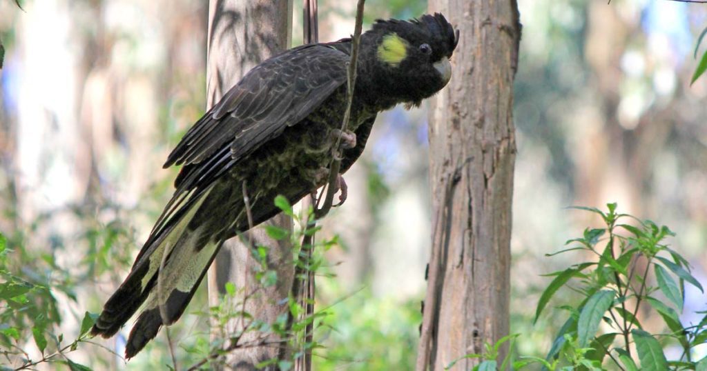
The final leg of your journey is simply following Lebruns Road for its entire 2.5 km until you get back to your car at the junction of Royston Road. Lebruns Road is a pleasant way to finish the walk – it is a comfortable stroll through drier forests, ending with a gentle decline to give your tired legs some respite. Lebruns Road is another good place to keep your eyes peeled for a wide variety of bird species.
Shorter options
If the full walk is too much, you can skip the detour to Rubicon Dam, leaving you with around a 11 km hike that will take 3 to 4 hours.
Another option is to only do the Heritage Walk. This walk follows the path outlined above, except you don’t go all the way to the forebay. Instead, a few hundred metres past the Siphon Trestle, you will see two small bridges across the aqueduct with a green Heritage Walk arrow marker. Follow the direction of the marker across the bridge and up a track into the forest. This track leads back up to the Heritage Walk trailhead. This will give you about an 8 km hike, taking about 2 to 3 hours.
Of course, for a very short walk, you can always do the Heritage Walk without the trip to the Rubicon Dam. This loop is around 2 km, taking about 40 mins to 1 hour.
For a map of the walking tracks, search for “FS0055-Rubicon-State-Forest.pdf” and click on the first result. You can also find GPS data files and alternative routes at trailhiking.com.au/hikes/rubicon-aqueducts